Descrizione
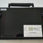
Standard Bundle con batteria, hard case, Smart Controller v3 2000 NIT, caricatore singolo + corso 2 ore via zoom + manuali aeronautici + manuali in Italiano.
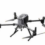
AUTEL EVO Max 4T ha un payload versatile che può supportare una varietà di sensori per un’ampia gamma di applicazioni. La sua Enterprise App è specificamente progettata per ottimizzare la cooperazione tra droni e piloti. Questo drone può eseguire missioni di volo semi-autonome, individuazione di percorsi autonomi, live streaming, acquisizione di bersagli e altro ancora. Include anche funzioni di accessibilità intelligenti. Le potenziali applicazioni per EVO Max 4T includono ricerca e soccorso, supporto antincendio, mappatura e ispezione.payload

Nessun punto cieco
Evitamento definitivo degli ostacoli
AUTEL EVO Max 4T è l’unico drone commerciale che combina i tradizionali sistemi di visione binoculare con tecnologia radar a onde millimetriche. Ciò consente l’autonomia Autel a bordo di EVO Max 4T
Motore per percepire oggetti fino a 0,5 pollici, eliminando i punti ciechi e consentendo il funzionamento in condizioni di scarsa luminosità o pioggia.

Anti JAM e Interferenze
Anti JAM e Interferenze
L’EVO Max 4T utilizza moduli e algoritmi di controllo di volo avanzati appositamente progettati per contrastare lo spoofing RFI, EMI e GPS. Ciò consente all’EVO Max 4T di volare con sicurezza vicino a linee elettriche, strutture critiche e in aree complesse.

Ricerca autonma di percorsi
Max 4T raccoglie i dati ambientali circostanti e pianifica percorsi di volo 3D attraverso ambienti complessi come montagne, foreste ed edifici.
I casi d’uso includono la ricostruzione rapida della scena 3D, il controllo della sicurezza pubblica, l’ispezione industriale e il rilevamento del territorio

Navigazione in ambienti senza GPS
I sensori avanzati consentono all’EVO Max 4T di navigare all’interno di strutture rinforzate, sotterranee o in ambienti senza GPS.
Identificazione e tracciamento accurati degli oggetti
Basato sulla tecnologia di riconoscimento AI di Autel, EVO Max 4T può identificare e agganciare automaticamente diversi tipi di obiettivi come fonti di calore, persone in movimento o veicoli e ottenere il monitoraggio ad alta quota e la raccolta di dati per le forze dell’ordine.
A-Mesh 1.0 – La migliore tecnologia di interconnessione fra droni
EVO Max 4T è dotato del nuovo sistema A-Mesh, che consente la comunicazione, la connessione e la collaborazione autonome da drone a drone.


Autel Enterprise App Platform
L’app Autel Enterprise è stata creata da zero per applicazioni industriali e presenta un’interfaccia nuova di zecca per un funzionamento semplice ed efficiente. Funzionalità aggiuntive e modalità semi-autonome massimizzano la capacità di missione di AUTEL EVO Max 4T
Per maggiori informazioni EVO Max 4T-Autel Robotics

| Weight | 3.5 lbs (1600g, battery and gimbal included) |
| Max. Takeoff Weight | 4.41 lbs (1999 g) |
| Dimensions | 576*660*149 mm (folded, incl. propellers) 340*407*148 mm (folded, excl. propellers) 257*136*133 mm (unfolded, excl. propellers) |
| Diagonal Wheelbase | 1.52 ft (464mm) |
| Max Ascent Speed | 8m/s |
| Max Descent Speed | 6m/s |
| Max Horizontal Speed (windless near sea level) | 23m/s |
| Max Service Ceiling Above Sea Level | 23000ft (7000m) |
| Max Flight Time (windless) | 42 mins |
| Max Hovering Time (windless) | 38 mins |
| Max Wind Resistance | 27mph* *Takeoff and landing can withstand wind speeds up to 27 mph (12 m/s). |
| IP Rating | IP43 |
| Max Tilt Angle | 35° |
| Max Angular Velocity | Pitch: 300°/s; Yaw: 120°/s |
| Operating Temperature | -4°F to 122°F (-20℃ – 50℃) |
| Operating Frequency | 2.4G/5.2G*/5.8G/900MHz* |
| GNSS | GPS+Galileo+BeiDou+GLONASS |
| Transmitter Power (EIRP) | 2.4GHz:<33dBm(FCC), <20dBm(CE/SRRC/MIC) 5.8GHz:<33dBm(FCC), <30dBm(SRRC), <14dBm(CE) 5.15-5.25GHz: < 23dBm(FCC/SRRC/MIC) 5.25-5.35GHz:<30dBm(FCC), <23dBm(SRRC/MIC) |
| Hovering Accuracy | Vertical: ±0.1 m (Vision System enabled); ±0.3 m (GPS enabled); ±0.15 m (RTK enabled); Horizontal: ±0.15 m (Vision System enabled); ±0.3 m (GPS enabled); ±0.1 m (RTK enabled); |
-
Gimbal
Mechanical Range Pan: -135° to 45°
Tilt: -45° to 45°
Roll: -45° to 45°Controllable Range -90° to 30° Stable system 3-axis mechanical gimbal (pan, tilt, roll) Max Control Speed (pitch) 200º/s Angular Vibration Range <0.005° -
Zoom Camera (Telephoto)
Sensor 1/2″ CMOS, Effective pixels: 48M Lens Focal length: 11.8-43.3mm (35mm, equivalent: 64-234mm)
Aperture: f/2.8-f/4.8Exposure Compensation ±3EV 0.3EV/step ISO Range Normal Mode:
Auto: ISO100 ~ ISO6400
Manual:
Photo: ISO100 ~ ISO12800
Video: ISO100 ~ ISO6400Shutter Speed Photo: 8s ~ 1/8000s
Video: 1s ~ 1/8000sMax Photo Size 8000×6000 Max Video Resolution 7680×4320 -
Wide Camera
Sensor 1/1.28 CMOS, Effective pixels: 50M Lens DFOV: 85°
Focal length: 4.5 mm (equivalent: 23 mm)
Aperture: f/1.9
AF motor: 8-wire SMA, PDAF focusExposure Compensation ±3EV 0.3EV/step ISO Range Auto:
Photo: ISO100~ISO6400
Video: ISO100~ISO64000 (Night scene mode: up to ISO64000)
Manual:
Photo: ISO100~ISO12800
Video: ISO100~ISO6400Shutter Speed Photo: 8s ~ 1/8000s
Video: 1s ~ 1/8000sMax. Video Resolution 3840×2160 Photo Size 8192*6144
4096*3072 -
Thermal Camera
Thermal Imager Uncooled VOx Microbolometer Lens DFOV: 64°
Aperture: 13mm
Focus: f/1.2Infrared Temperature Measurement
Accuracy26.6~37.4 ℉ or reading ±3% (using
the larger value) @ambient
temperature -4℉ to 140℉Video Resolution 640*512 Photo Size 640*512 Pixel Pitch 12 um Temperature Measurement Method Center measurement, pot measurement, rectangular measurement Temperature Measurement Range -4℉ to 302℉, 32℉ to 1022℉ (-20°C to 150°C, 0 to 550°C) Temperature Alert High and low temperature alarm thresholds, reporting coordinates and temperature values -
Laser Range Finder
Measurement Accuracy ±3.3ft (1m) Measuring Range 3937ft (1200m) -
Image Transmission
Operating Frequency 2.4G/5.2G*/5.8G/900MHz*
*5.2GHz is only applicable for FCC, CE, and UKCA regions. 900MHz is only applicable for FCC regions.Max Transmission Distance
(unobstructed, free of interference)12.4 miles/20km (FCC), 4.9 miles/8km (CE) Independent Networking Autel Smart Controller V3 Transmitter Power (EIRP) 2.4GHz:<33dBm(FCC), <20dBm(CE/SRRC/MIC)
5.8GHz:<33dBm(FCC), <30dBm(SRRC), <14dBm(CE)
5.15-5.25GHz: < 23dBm(FCC/SRRC/MIC)
5.25-5.35GHz:<30dBm(FCC), <23dBm(SRRC/MIC) -
Autonomy
Non-GPS Hovering and Manual Flight Indoor: Horizontal error ≤1.18in (At least have texture at one direction)
Outdoor:
Daytime: Within 1640ft (500m) flight height, horizontal error < 0.01*height
Night: Manual flight is controllable within 328ft (100m) flight heightNon-GPS Return-to-Home Within 1640ft (500m) flight height, horizontal error of Return-to-Home point < 11.81in Automatic Obstacle Rerouting High Speed Obstacle Rerouting: Flight speed up to 45mph (20m/s) when Min. safety distance to obstacle is 4.9ft (1.5m)
High Precision Obstacle Rerouting: Flight speed could reach 6.7mph (3m/s) when Min. safety distance to obstacle is 1.64ft (0.5m)Multi-target Recognition and Tracking Target identification types: people, vehicles, boats
Number of targets detected: 64
Comprehensive recognition accuracy: > 85% -
Millimeter-wave Radar Sensing System
Frequency 60Ghz~64Ghz*
*Please fly safely and consult your local laws and regulations.Size 1.5*0.55*0.08 in (38*14*2mm) (L*W*H) Weight 0.07oz (2g) EIRP 18dBm Sensing Range Upward: 5.9~787.4in (0.15~20m)
Downward: 3.9~4724.4in(0.1~120m)
Forward and Backward (Standard/Comfortable): 0.82~98.43ft (0.25~30m)
Forward and Backward(Ludicrous): 1.64~196.85ft (0.5~60m)FOV Horizontal(6dB):±60°,Vertical(6dB):±30° Speed Measurement Range ± 134mph (60m/s) Speed Measurement Accuracy ≤1% Max. Target Detection Number 32 -
Visual Sensing System
Obstacle Sensing Range Forward/Upward/Downward/Backward/Sideward: 0.2~50m FOV Forward/Backward/Sideward: 60°(H),80°(V)
Upward/Downward: 360°(H),190°(V) -
Autel Smart Controller V3
Screen 7.9 inch, 2000nits max. brightness, 2048*1536 resolution External Battery Capacity: 5800mAh
Voltage: 11.55V
Battery Type: Li-on
Energy: 67Wh
Charing time: 120mins
Intelligent Lithium Ion BatteryOperating Time 3 hours (Max. brightness)
4.5 hours (50% brightness)Max Transmission Distance
(with interference)12.4 miles/20km (FCC), 4.9 miles/8km (CE) IP Rating IP43 Storage 128G GNSS GPS+GLONASS+Galileo+Beidou+NavIC+QZSS Operating Temperature -4°F to 104°F (-20℃ to 40℃) Wi-Fi Protocol WiFi Direct, Wi-Fi Display,
802.11a/b/g/n/ac
Support 2 x 2 MIMO Wi-FiOperating Frequency 2.400 – 2.4835 GHz;
5.150 – 5.250GHz;
5.725 ‒ 5.850 GHzTransmitter Power (EIRP) 2.400 – 2.4835 GHz
FCC/CE:≤20dBm
5.150 – 5.250GHz
FCC:≤17dBm
5.725 ‒ 5.850 GHz
FCC:≤17dBm
CE:≤14dBm -
Aircraft Battery
Capacity 8070mAh Voltage 14.88V Battery Type LiPo 4S Energy 120wh Net Weight 1.15 lbs (520g) Charging Temperature 41° F to 113° F (5ºC to 45ºC) When the temperature is lower than 10° C (50° F), the selfheating function will be automatically enabled. Charging in
a low temperature may shorten the lifetime of the battery.Hot Swap Support


